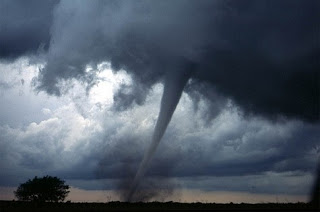

How tornadoes are predicted days or even hours in advance is not easy. There are numerous ingredients that cause tornadoes and go into predicting the possibility for tornadoes. Here is how the NWS predicts tornadoes and how you can also predict tornadoes.
Predicting Tornadoes Days and Hours in Advance
Located in the middle of tornado alley in Norman, Oklahoma, the National Weather Service Storm Prediction Center (SPC) is the place that watches for the possibility of tornadoes and severe thunderstorms for the entire United States.
What is actually predicted days in advance is the likelihood or percentage possibility of tornadoes occurring in a certain area. The possibility of tornadoes can be predicted by watching for certain weather conditions with a fairly accurate percentage rate.
The first ingredient forecasters could look at is warm humid air ahead of a predicted cold front, which can cause wind shear and is one ingredient in the formation of tornadoes.
The cooler dry air behind a front meeting the warm humid air sometimes forms what is called a dryline, and at this juncture is where severe thunderstorms and tornadoes can form.
The National Weather Service (NWS) forecasters look at temperature, dew point and wind shear to determine the chances for severe thunderstorms that might produce a tornado in a given area.
Wind shear is the changing of wind speed and or wind direction at different heights, from the surface upwards and is one main reason tornadoes form.
CAPE is measured in joules per kilogram (j/kg) of energy. The higher the number, the more unstable the atmosphere is and the greater the chance of severe or tornado producing thunderstorms. CAPE measures the buoyancy of the atmosphere, the stronger the CAPE, the more upward force.
Upward forcing is what causes updrafts, causing thunderstorms to grow taller, larger and more severe, which could lead to tornadoes.
A CAPE above 1200 j/kg is very unstable and could mean severe thunderstorms. But a high CAPE doesn’t always mean there will certainly be a severe thunderstorm or tornado, there are other factors as well.
CIN or the cap is another important factor whether or not a severe thunderstorm and tornadoes can form. CIN stands for convective inhibition.
This means that the atmosphere is such that it inhibits updrafts, which means thunderstorms cannot form and if they do, they will not become severe or form tornadoes.
CIN is like a cap or lid, capping the updrafts. If the cap is broken during the day, that is when a thunderstorm can rapidly develop and you can actually watch the updraft as the thunderstorm grows taller and could possibly become a severe thunderstorm and produce tornadoes.
The cap can usually be broken when the air temperature and the dew point reach a certain level. Knowing the CAPE, CIN, wind shear, temperature and dew point is a way to predict the possibility of severe thunderstorms and tornadoes for that day.
You can find out what your local NWS office predicts the CAPE to be for that day or days in advance by going to your local NWS web site and looking for what is called the “forecast discussion”.

How Doppler Radar Can See Possible Tornadoes
NEXRAD, Next Generation Radar is a Doppler radar which can measure rainfall rates, intensity and wind speed and direction.
The radar beam returns a higher reading for intense rain and an even higher reading for hail since hail reflects a bigger signal back to the radar. Large hailis many times associated with severe thunderstorms and possible tornadoes.
When you look at NWS radar, you will see a graph that is labeled DBZ, which stands for decibels of reflectivity. This measures the intensity of the rain or hail in the thunderstorm. The larger the number, the more intense the storm is. Anything above 50 DBZ is considered a strong thunderstorm and could be capable of producing a tornado.
The Hook Echo
More importantly, Doppler radar can see motion. This can tell the meteorologist if a thunderstorm has a rotating column of air area within the thunderstorm called a “mesocyclone”. Approximately 40% of all mesocyclones produce tornadoes.
 |
| NWS radar hook echo |
Rotation in a thunderstorm or mesocyclone can sometimes be seen on radar by what is called a hook echo. When the NWS sees a hook echo on their radar, many times they will then issue a tornado warning.
What this hook echo actually is is rain wrapping around the rotation in that area of the thunderstorm. This rotation is in the thunderstorm, above the ground.
Tornado Watches and Warnings
If the conditions look good that a certain area will have tornadoes, the Severe Prediction Center will issue a tornado watch. This means that there is a possibility of severe thunderstorms that can cause tornadoes in that area. This is the first step in predicting tornadoes.
A tornado warning is issued by the local NWS office when a tornado is already occurring or imminent. This means that the public or a trained storm spotter has seen a funnel or a tornado or meteorologist have seen a hook echo on radar.
 |
| NWS Doppler Radar of a tornado |
Predicting Tornadoes with Computer Models
The SPC has collected data from hundreds of areas in the US that had tornado producing thunderstorms and put this data into an equation.
This index is called the Significant Tornado Parameter and is now another tool in forecasting where and when severe thunderstorms and tornadoes might occur. New models are developed and tested each year to make predicting tornadoes more accurate.
Tornadoes cannot be predicted like a hurricane or even a day before they occur. But the NWS and the Severe Storm Prediction Center can give out good probabilities days and hours before.
© 2010-2019 Sam Montana


It's fascinating how meteorologists use factors like warm humid air, drylines, wind shear, CAPE, and CIN to assess tornado risk.
ReplyDelete